When advocating for better active transportation infrastructure, maps can be helpful for both doing research and presenting information. Many government agencies, communities and other organizations have maps available for public use. There are maps showing crash locations, roadway safety projects, traffic volumes, travel times, and more.
In this article, we highlight some of the maps that members of the Coalition of Arizona Bicyclists have found helpful. Examples of the following types of maps are listed below.
- Bicycle Lane Maps
- Community Development Maps
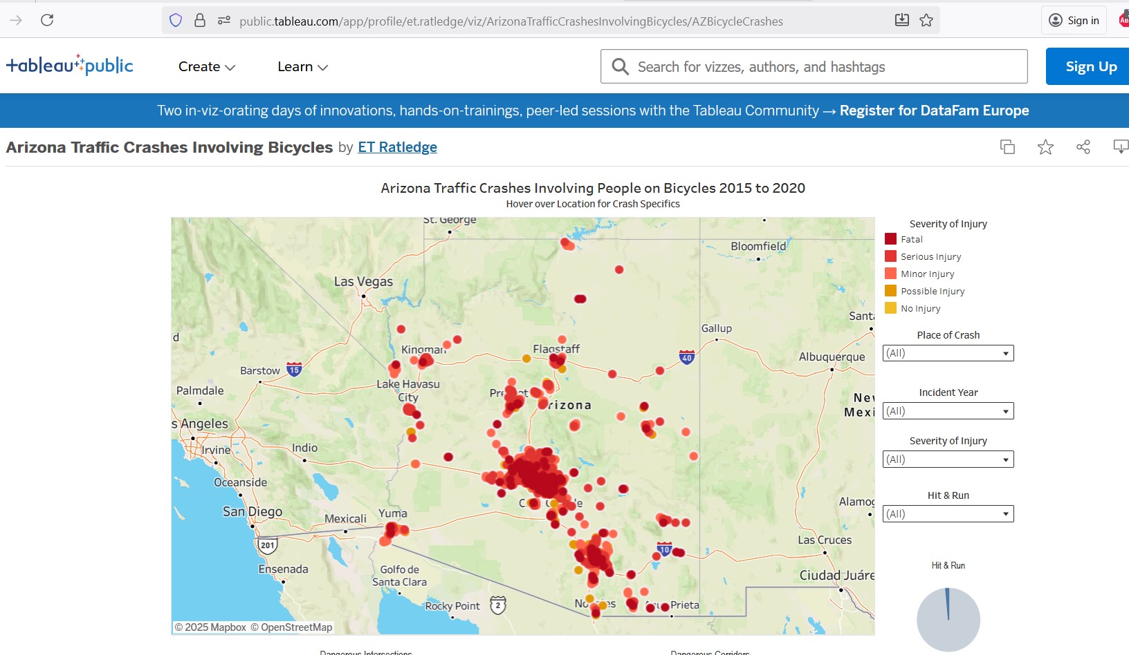
- Crash Location Maps
- Motorized Traffic Volume Maps
- Non-motorized Traffic Volume Maps
- Recreation Map
- Roadway Condition Maps
- Roadway Ownership Maps
- Roadway Safety Project Map
- Suggested Improvements Maps
- Travel Distance Maps
- Vehicle Ownership Map