When advocating for better active transportation infrastructure, maps can be helpful for both doing research and presenting information. Many government agencies, communities and other organizations have maps available for public use. There are maps showing crash locations, roadway safety projects, traffic volumes, travel times, and more.
In this article, we highlight some of the maps that members of the Coalition of Arizona Bicyclists have found helpful. Examples of the following types of maps are listed below.
- Bicycle Lane Maps
- Community Development Maps
- Crash Location Maps
- Motorized Traffic Volume Maps
- Non-motorized Traffic Volume Maps
- Recreation Map
- Roadway Condition Maps
- Roadway Ownership Maps
- Roadway Safety Project Map
- Suggested Improvements Maps
- Travel Distance Maps
- Vehicle Ownership Map
If there are maps in your community that are not listed below, please send the link to earlr@cazbike.org.
Bicycle Route Maps
Many communities have maps of existing bicycle routes and bicycle lanes available online. Some maps are interactive, some are static, and some are designed in a printable format.
Bicycle route maps can be useful for planning a ride or looking for areas where infrastructure improvement is needed.
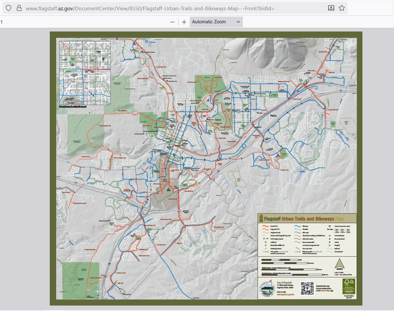
Flagstaff Urban Trails and Bikeways Map
Gilbert Multi-Use Trail Map
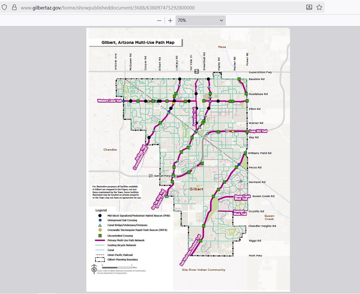
https://www.gilbertaz.gov/home/showpublisheddocument/3688/638097475292800000
Sierra Vista Bicycle and Share Use Path Map
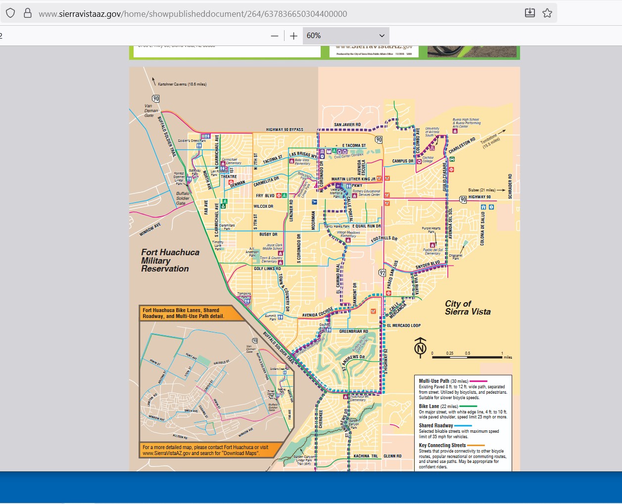
https://www.sierravistaaz.gov/home/showpublisheddocument/264/637836650304400000
Tucson Bikeways Map
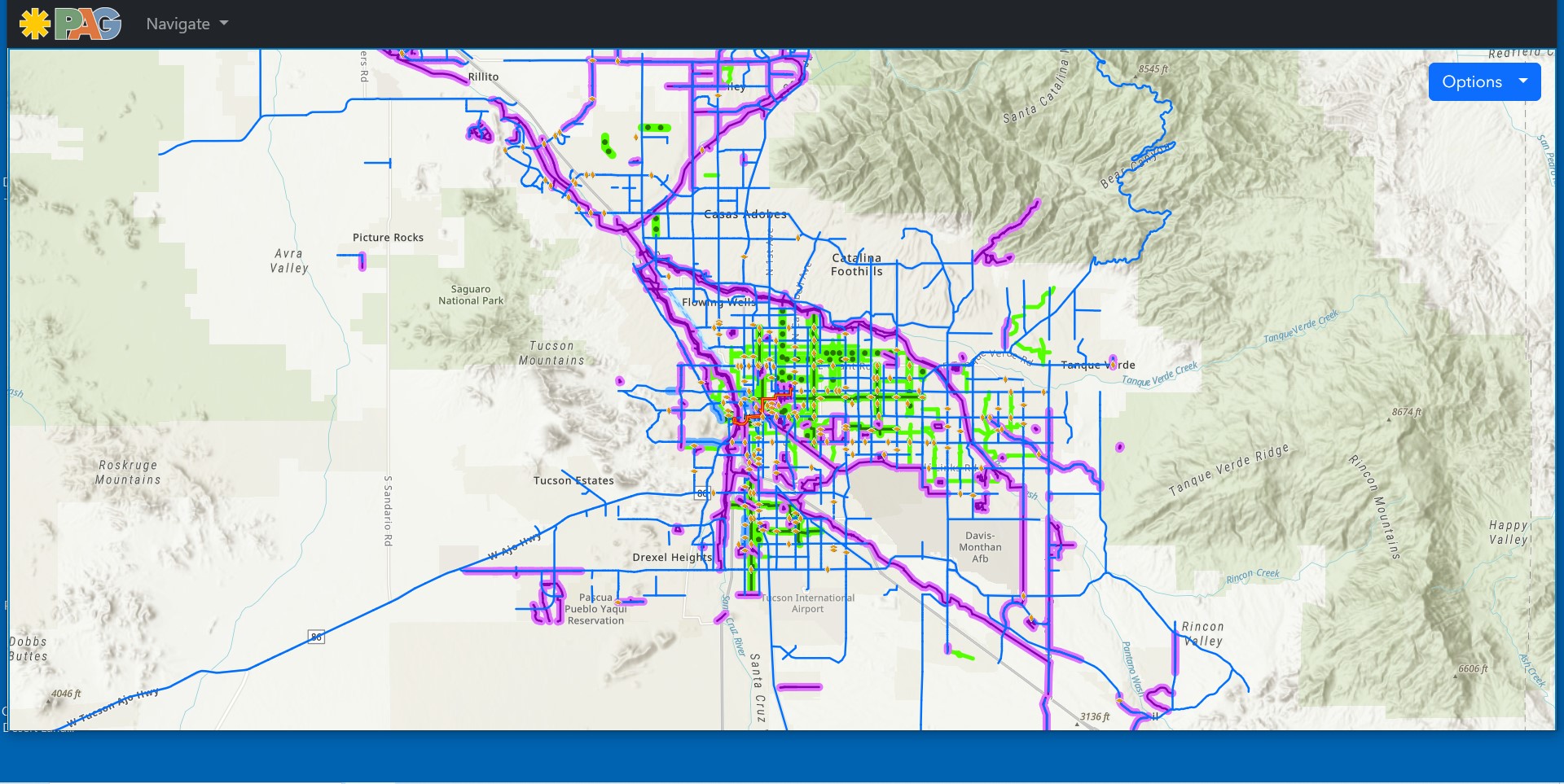
https://maps.pagregion.com/PAGBikePed/BikewaysMap.aspx
MAG Interactive Bikeway Map
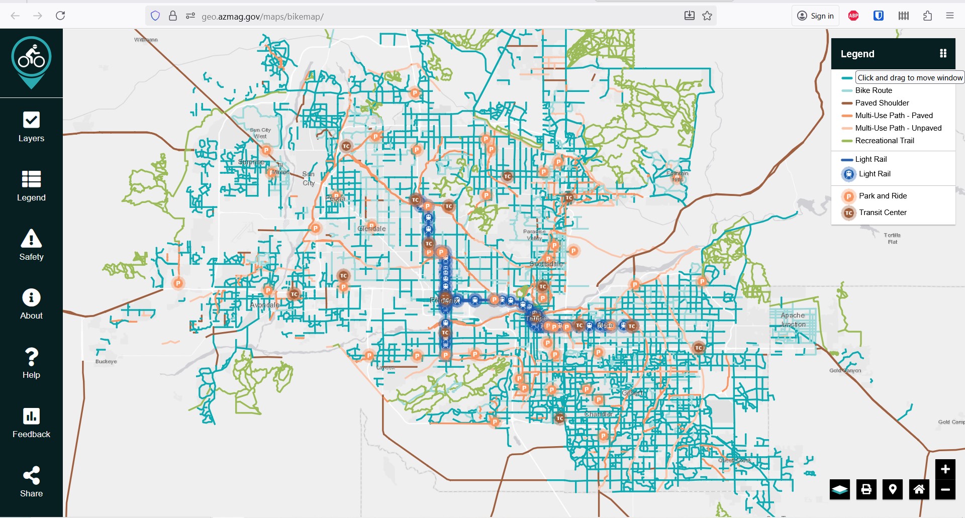
https://geo.azmag.gov/maps/bikemap/
MAG PDF Bikeway Map
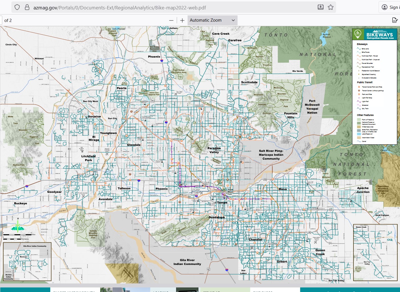
https://azmag.gov/Portals/0/Documents-Ext/RegionalAnalytics/Bike-map2022-web.pdf
Salt River Project Canal Path Map
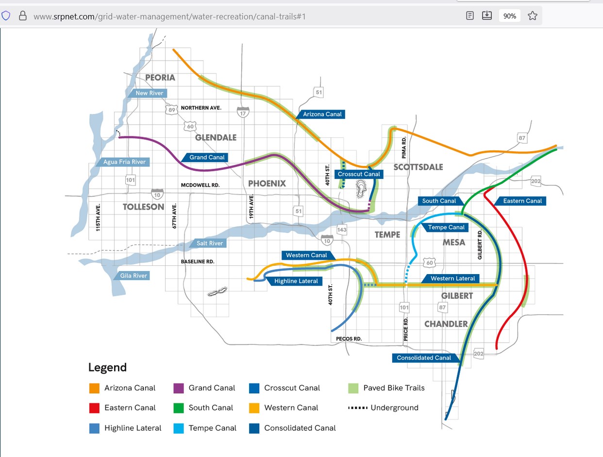
https://www.srpnet.com/grid-water-management/water-recreation/canal-trails#1
Suncloud Bikeway Map
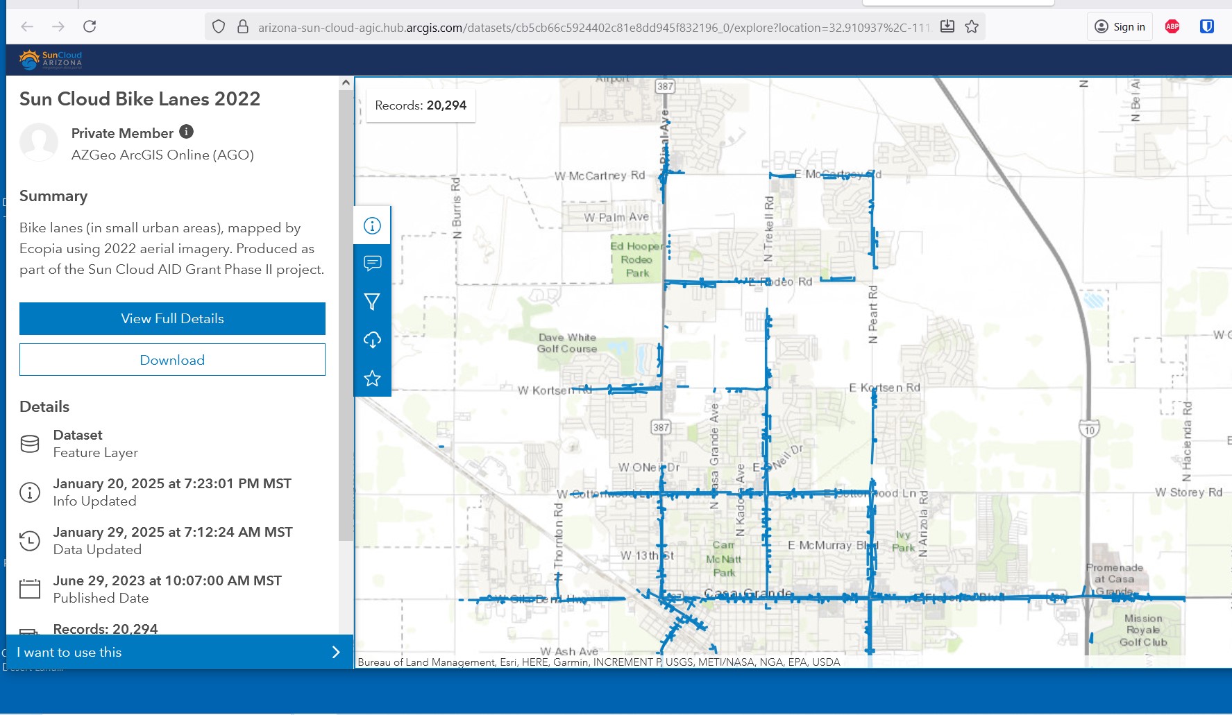
https://arizona-sun-cloud-agic.hub.arcgis.com/datasets/cb5cb66c5924402c81e8dd945f832196_0/explore
ADOT Bicycle Users Maps
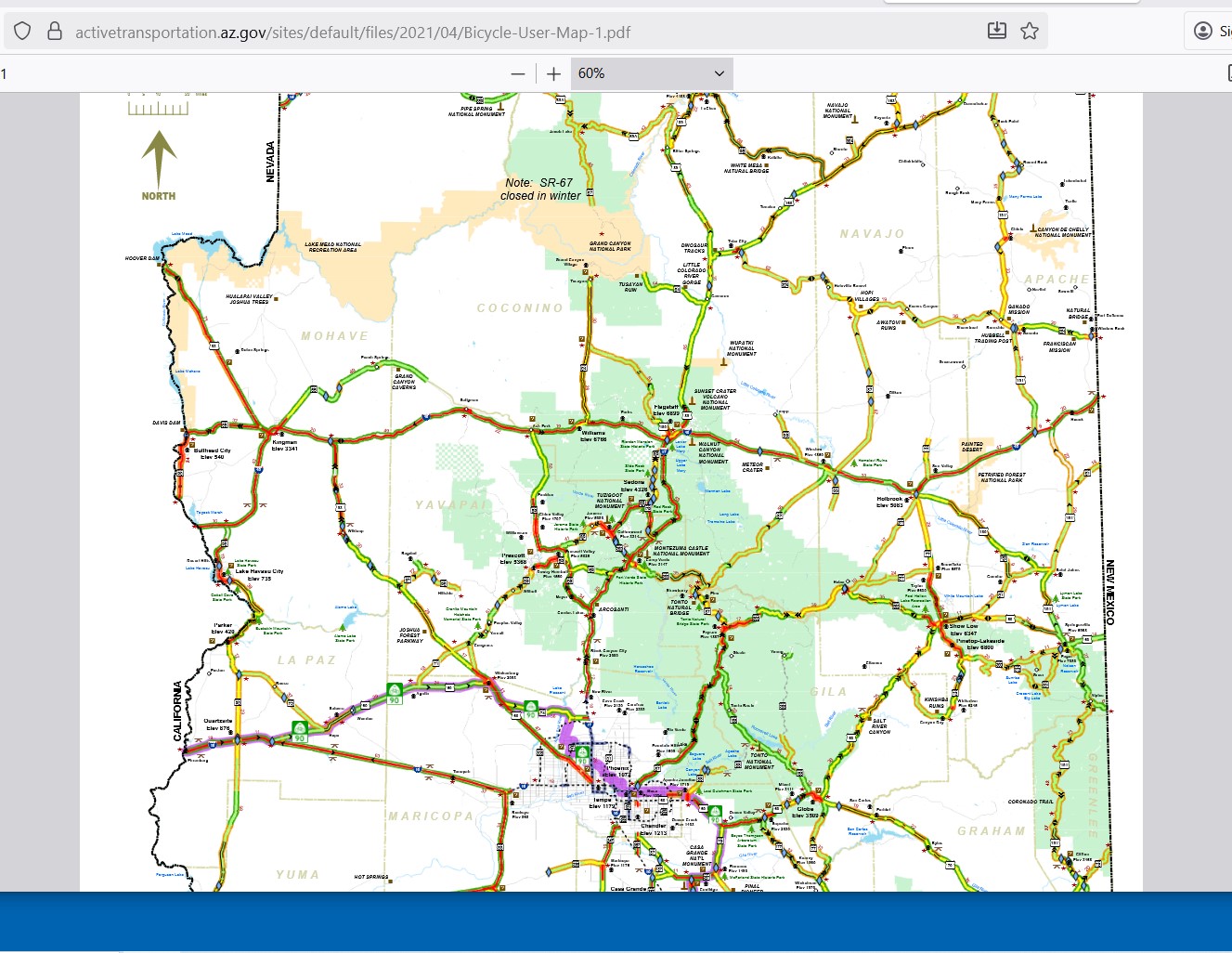
https://activetransportation.az.gov/sites/default/files/2021/04/Bicycle-User-Map-1.pdf
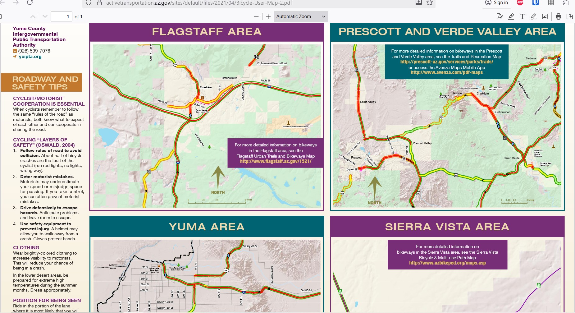
https://activetransportation.az.gov/sites/default/files/2021/04/Bicycle-User-Map-2.pdf
Community Development Maps
Maps are available that show future development, expected changes in population and work locations. These maps are useful for identifying places where changes to the roadway use and design or increases in traffic volume may indicate the need for better active transportation infrastructure.
The City of Mesa has an interactive map which can be used to see what current and future projects are being developed throughout the city. This includes both city projects and private projects that require permit and approval.
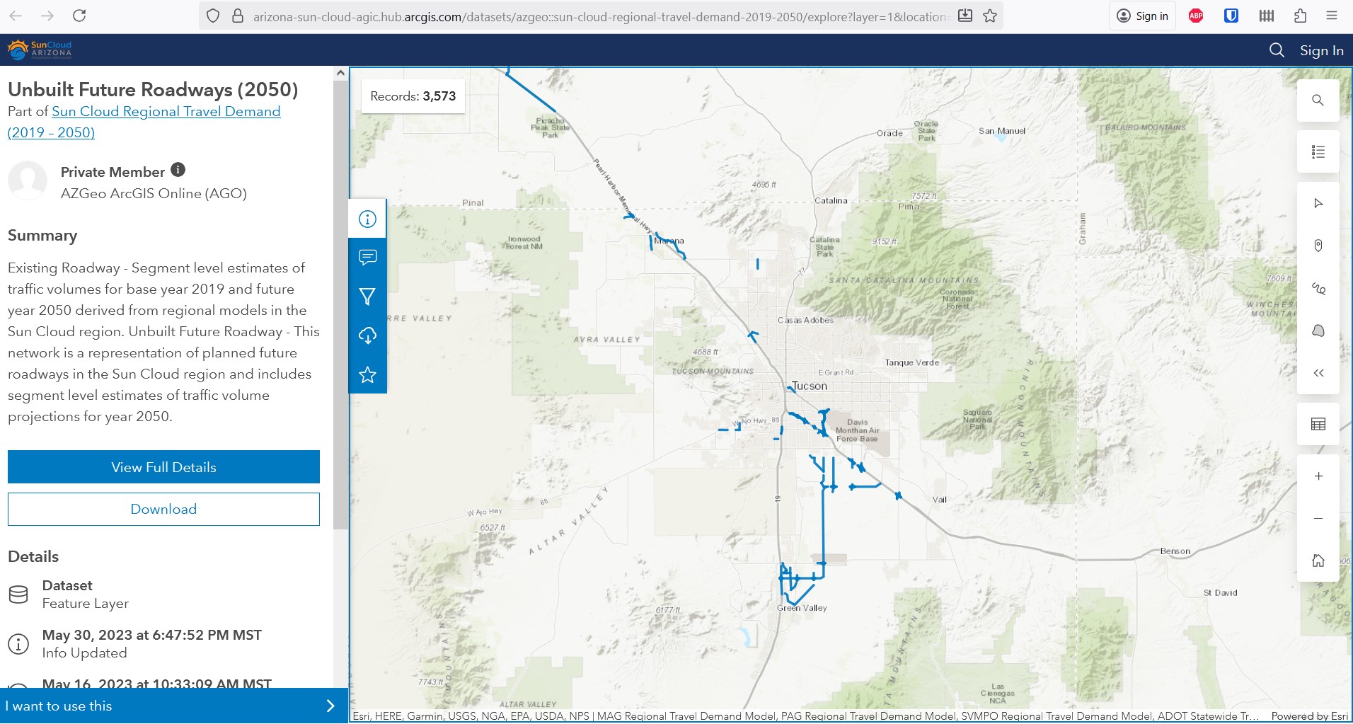
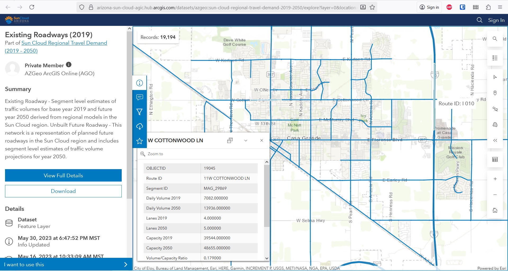
Suncloud Arizona has a map that shows roadways that are planned for development through 2050.
The Maricopa Association of Governments has maps that show were people in specific communities’ work. MAG also has maps showing projected population growth, and employment growth in the Maricopa Region.
Mesa Active Development Map
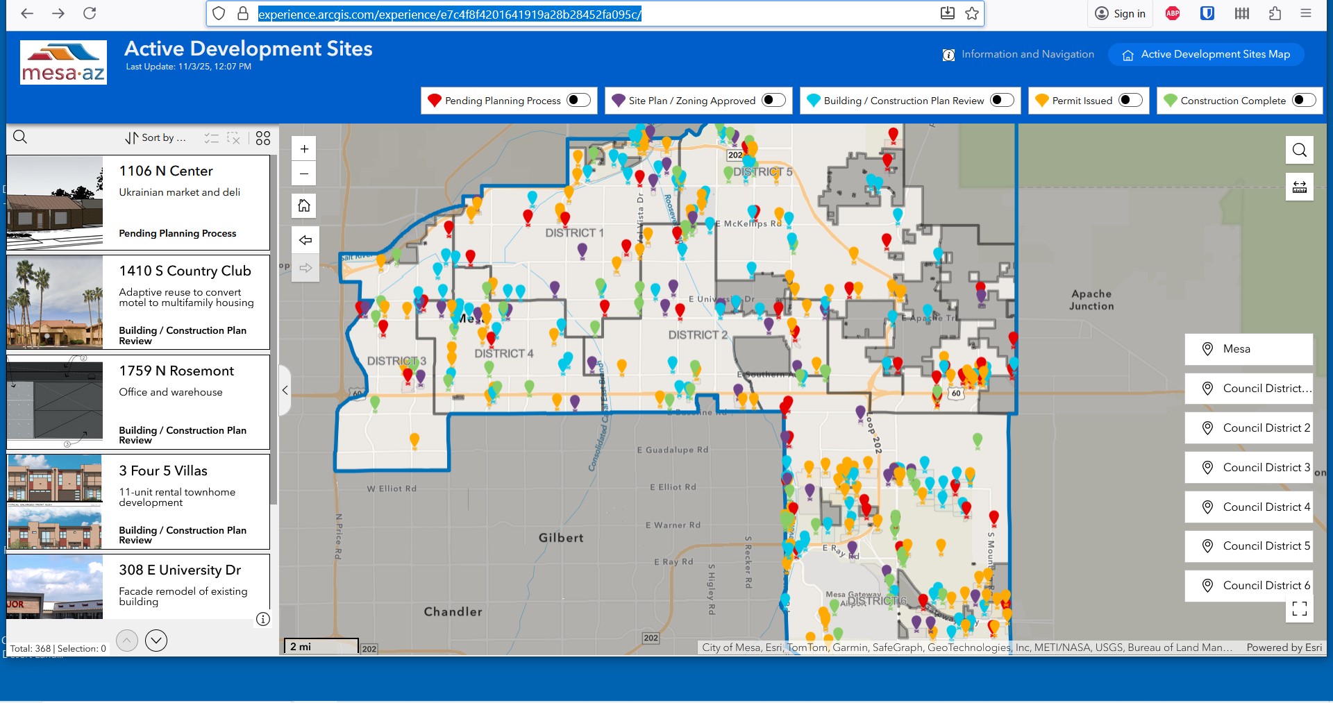
https://experience.arcgis.com/experience/e7c4f8f4201641919a28b28452fa095c/
Suncloud Unbuilt Future Roadways Map
MAG Live-Work Pattern Maps
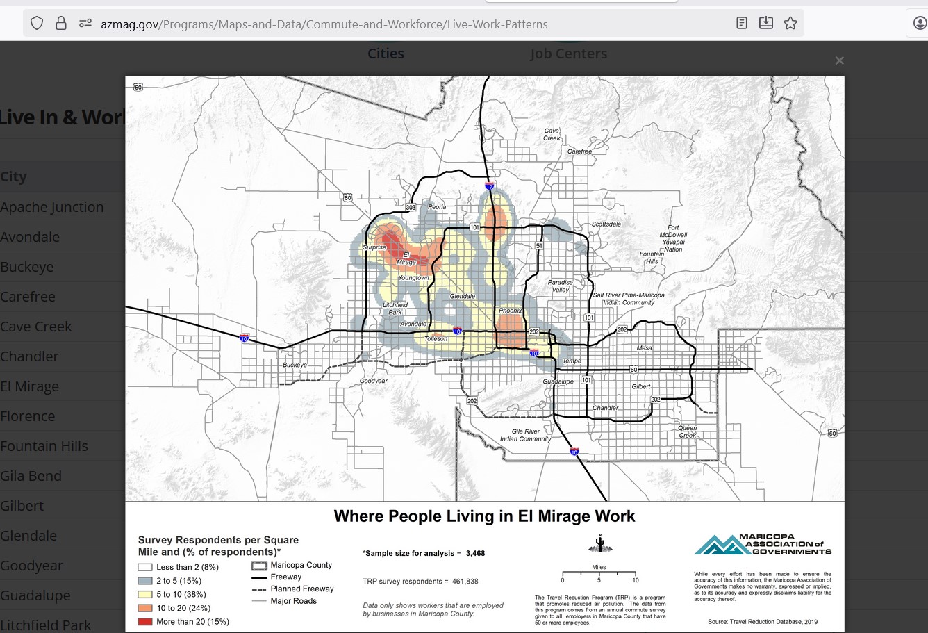
https://azmag.gov/Programs/Maps-and-Data/Commute-and-Workforce/Live-Work-Patterns
MAG Socioeconomic Projection Maps
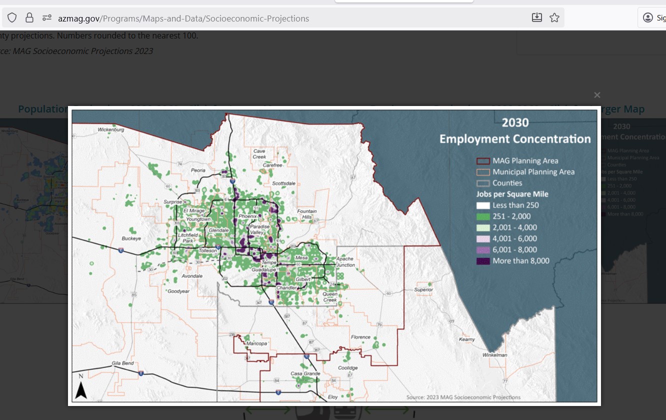
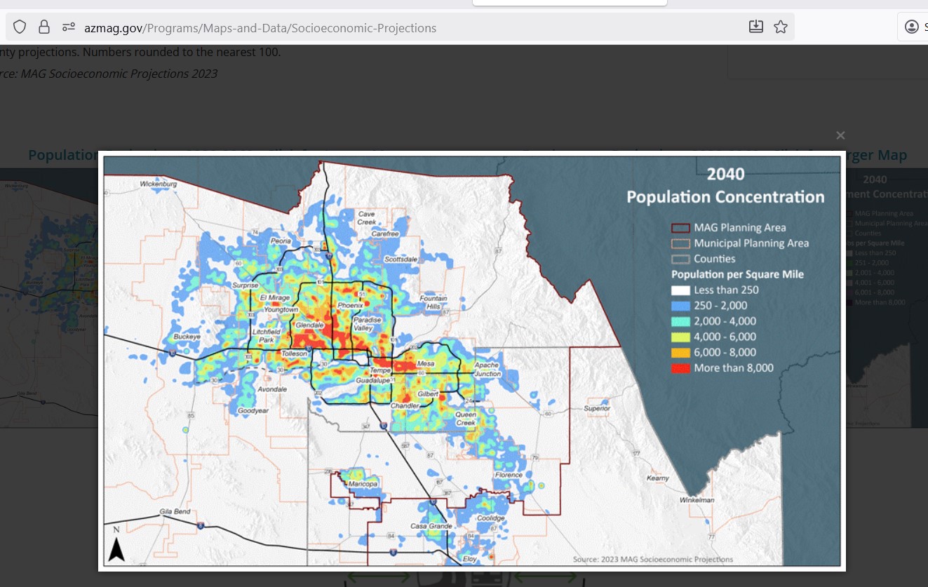
https://azmag.gov/Programs/Maps-and-Data/Socioeconomic-Projections
Crash Location Maps
Maps are available that provide a view of locations and networks with high injury crashes.
These maps can be used to identify intersections and roadway where better bicycle infrastructure is needed.
Phoenix High Injury Network Map
(You may have to click OK to a couple of popups to get to the map)
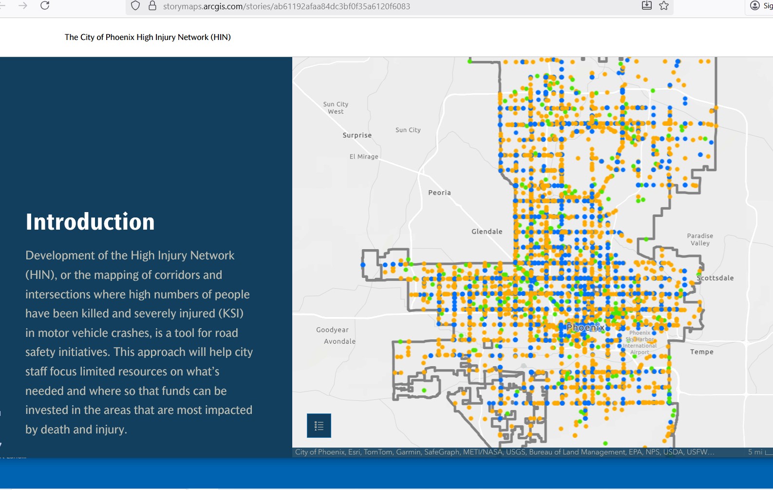
https://storymaps.arcgis.com/stories/ab61192afaa84dc3bf0f35a6120f6083
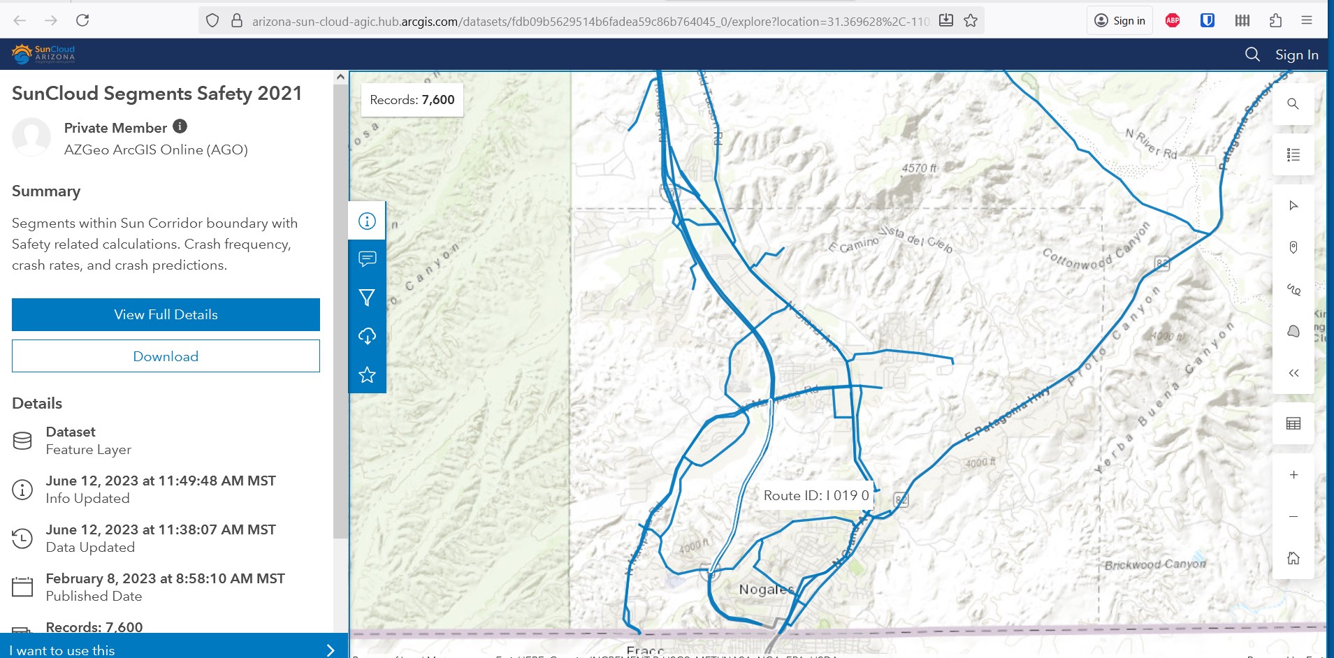
The Sun Cloud Explorer system has maps showing crashes throughout Cochise, Maricopa, Pima, Pinal, and Santa Cruz counties. One map shows crashes by intersection, with a popup window that includes a field to identify the ” Number of Non-motorized Fatality and Injury crashes”. Another Sun Cloud Explorer map shows crash information by roadway segment.
Sun Cloud Junction Safety Map
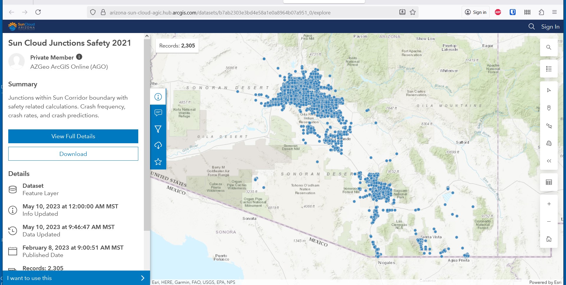
https://arizona-sun-cloud-agic.hub.arcgis.com/datasets/b7ab2303e3bd4e58a1e0a8964b07a951_0/explore
SunCloud Segments Safety Map
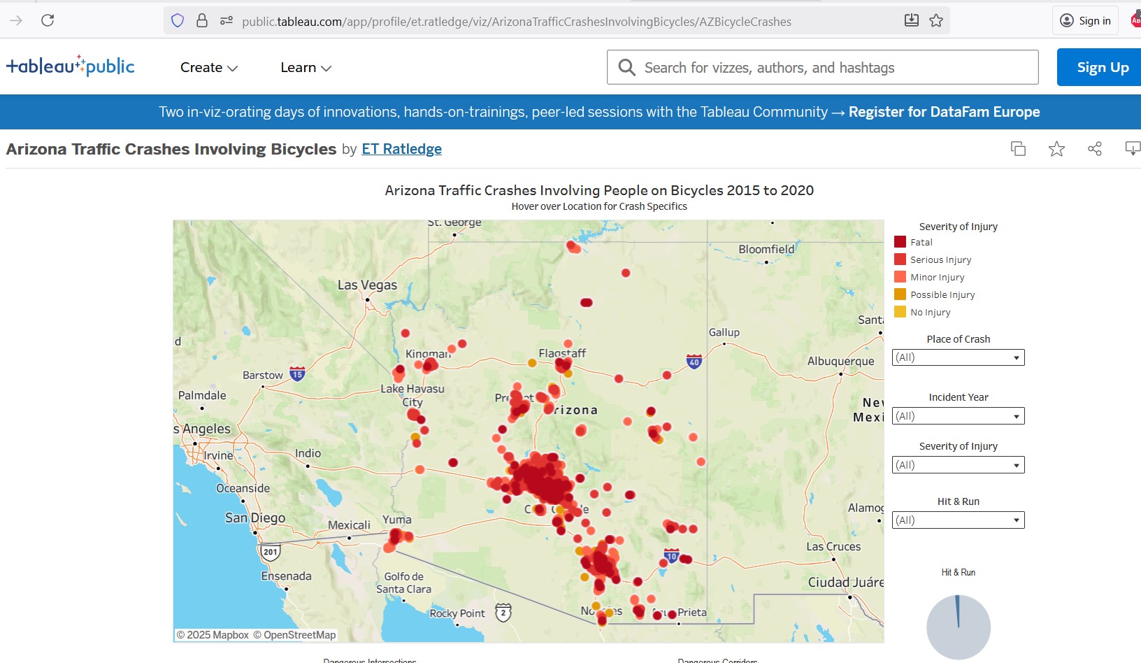
Another map, created by Coalition member Earl Ratledge, shows all crashes involving a person on a bicycle from 2015 to 2020. This map is interactive and can be filtered to a specific city.
Arizona Traffic Crashes Involving Bicycles
The White Line Nationwide Crash Data Map
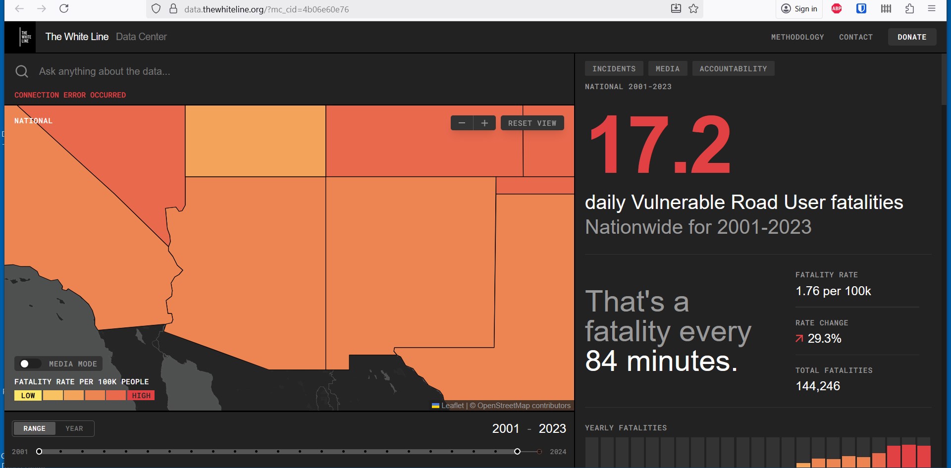
https://data.thewhiteline.org/?mc_cid=4b06e60e76
Motorized Traffic Volume Maps
Many communities and regional organizations around Arizona have maps showing motor vehicle traffic volumes on major roadways. Some maps are interactive, and some are pdfs.
These maps are another set of tools that can be used to determine if the appropriate bicycle infrastructure is in place or being added when roadways are improved. Motor vehicle traffic volumes along with motor vehicle traffic speeds are used as part of both the FHWA and NACTO guidance’s when determining what type of bicycle infrastructure is appropriate on a roadway.
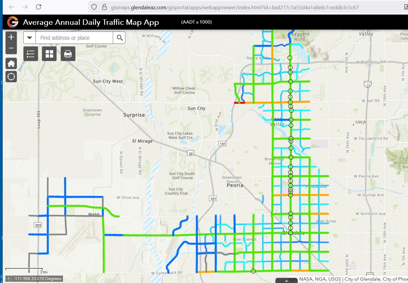
Glendale Motorized Traffic Map
Mesa Motorized Traffic Volume Map
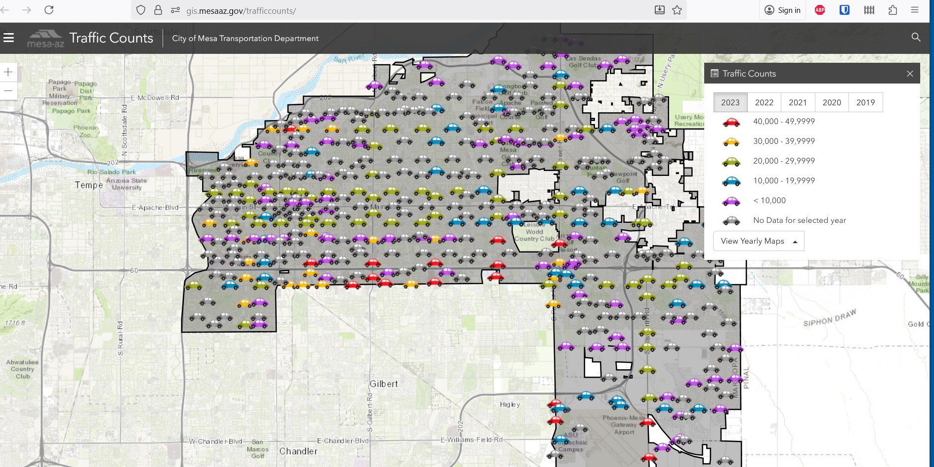
https://gis.mesaaz.gov/trafficcounts/
Prescott Motorized Traffic Count Map
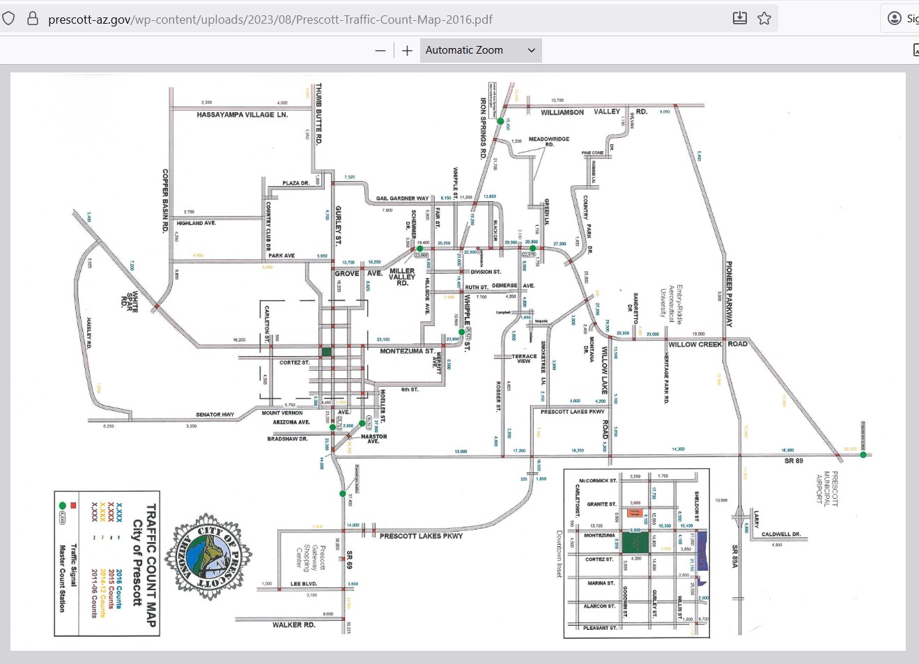
https://prescott-az.gov/wp-content/uploads/2023/08/Prescott-Traffic-Count-Map-2016.pdf
Sierra Vista Motorized Traffic Count Map
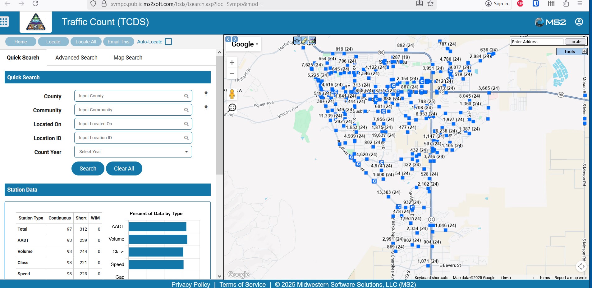
https://svmpo.public.ms2soft.com/tcds/tsearch.asp?loc=Svmpo&mod=
Tempe Motorized Traffic Count Map
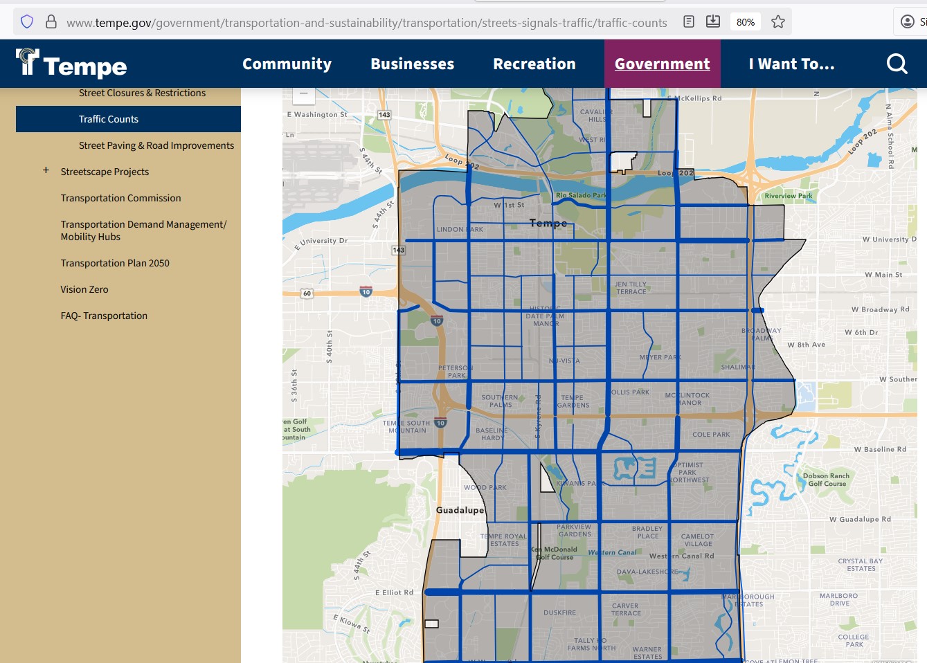
MAG Motorized Traffic Count Map
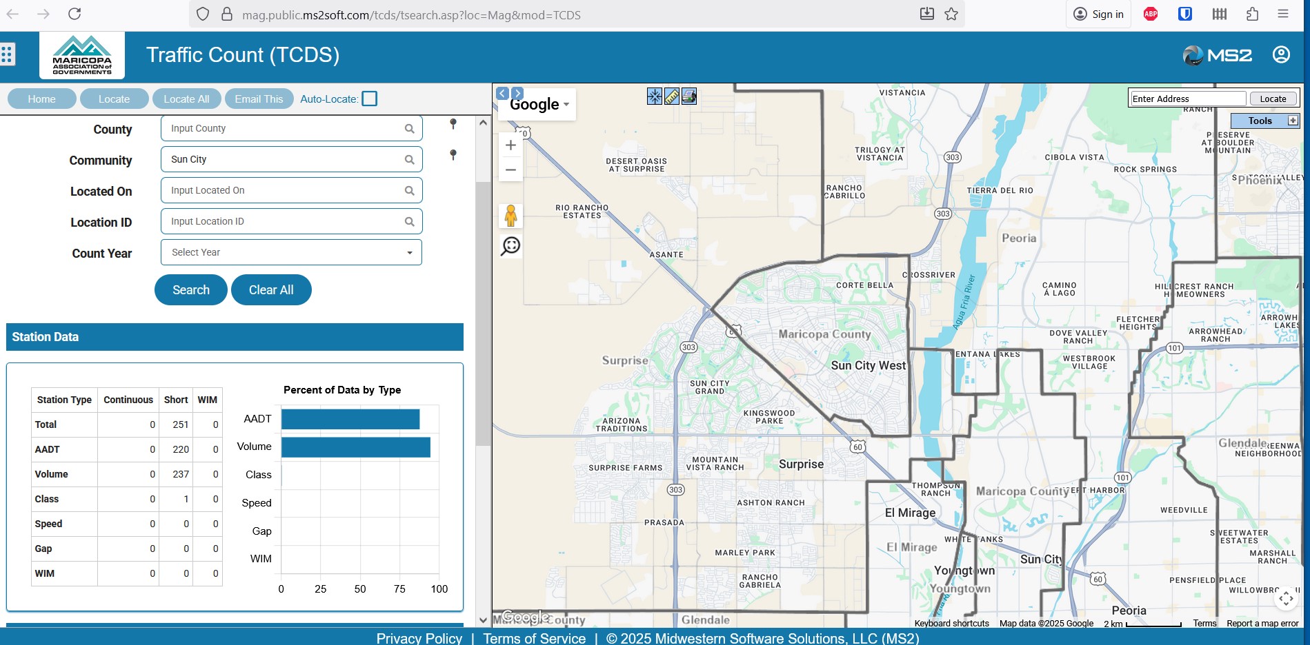
https://mag.public.ms2soft.com/tcds/tsearch.asp?loc=Mag&mod=TCDS
Sun Cloud Explorer Existing Roadways Existing Motorized Traffic Volume Map
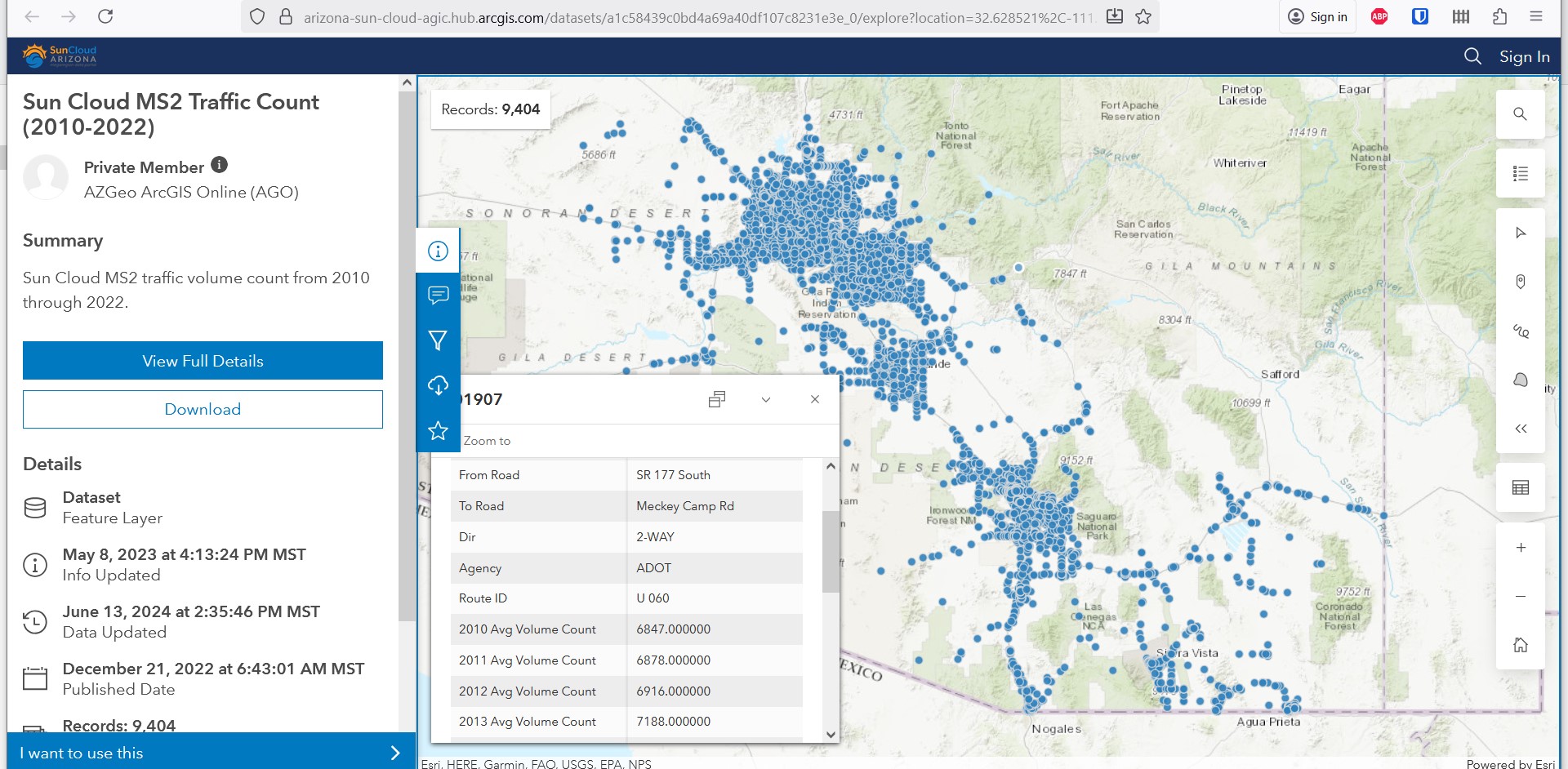
Suncloud Traffic Count Map
Non-motorized Traffic Volume Maps
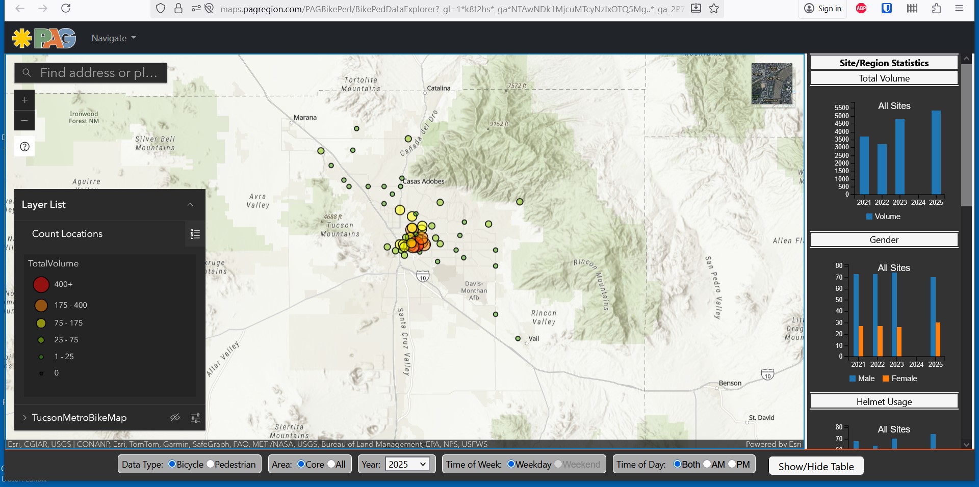
Both the Maricopa Region and the Pima Region have interactive maps showing non-motorized traffic volumes. Tempe Bicycle Action Group also does an annual count of people riding bicycles which is published online in report form.
These maps can be used to determine where better infrastructure is needed and can be correlated to motorized traffic volumes and high injury intersections and networks.
Tempe Bike Count Report
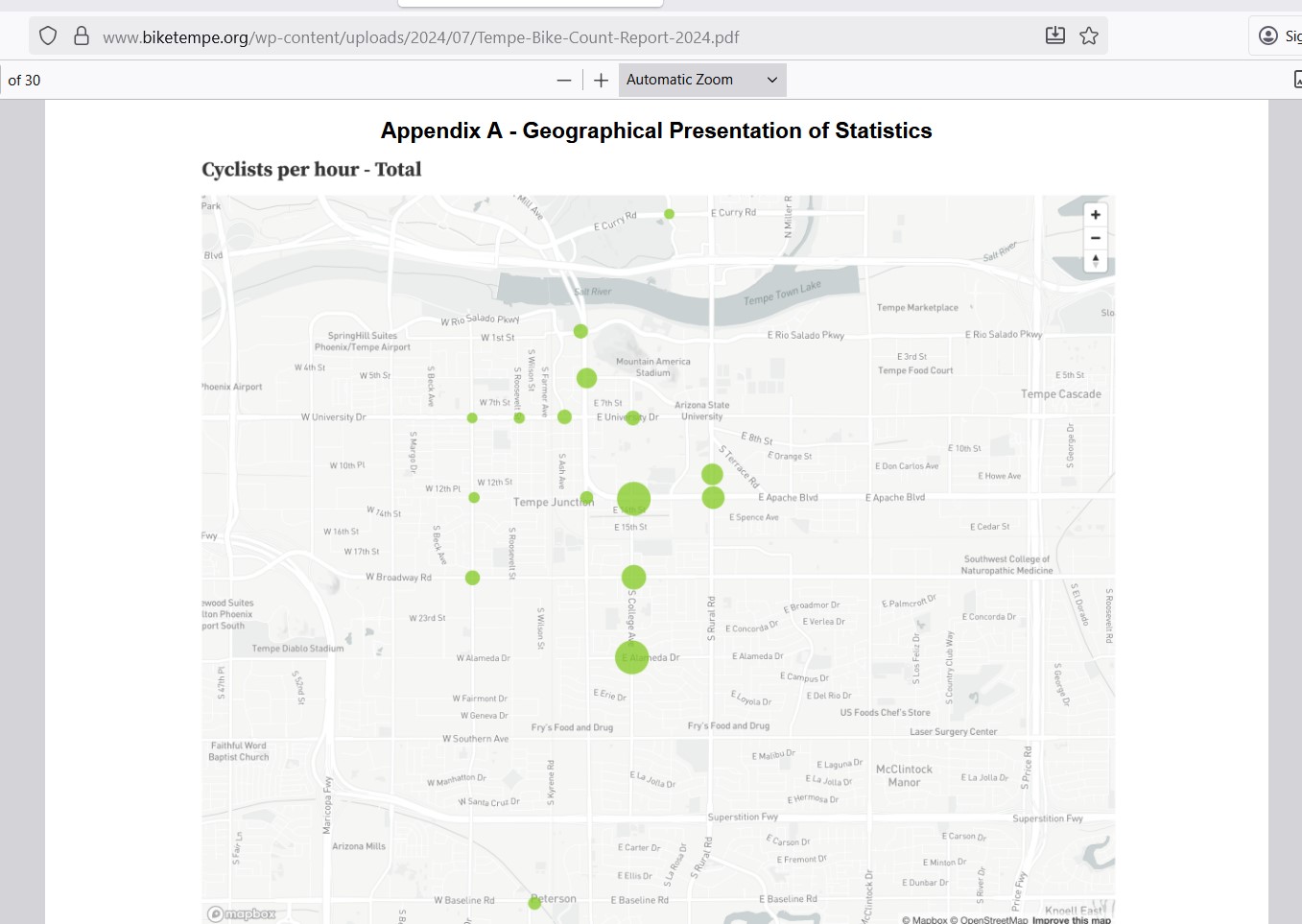
https://www.biketempe.org/wp-content/uploads/2024/07/Tempe-Bike-Count-Report-2024.pdf
MAG Non-motorized Volume Map
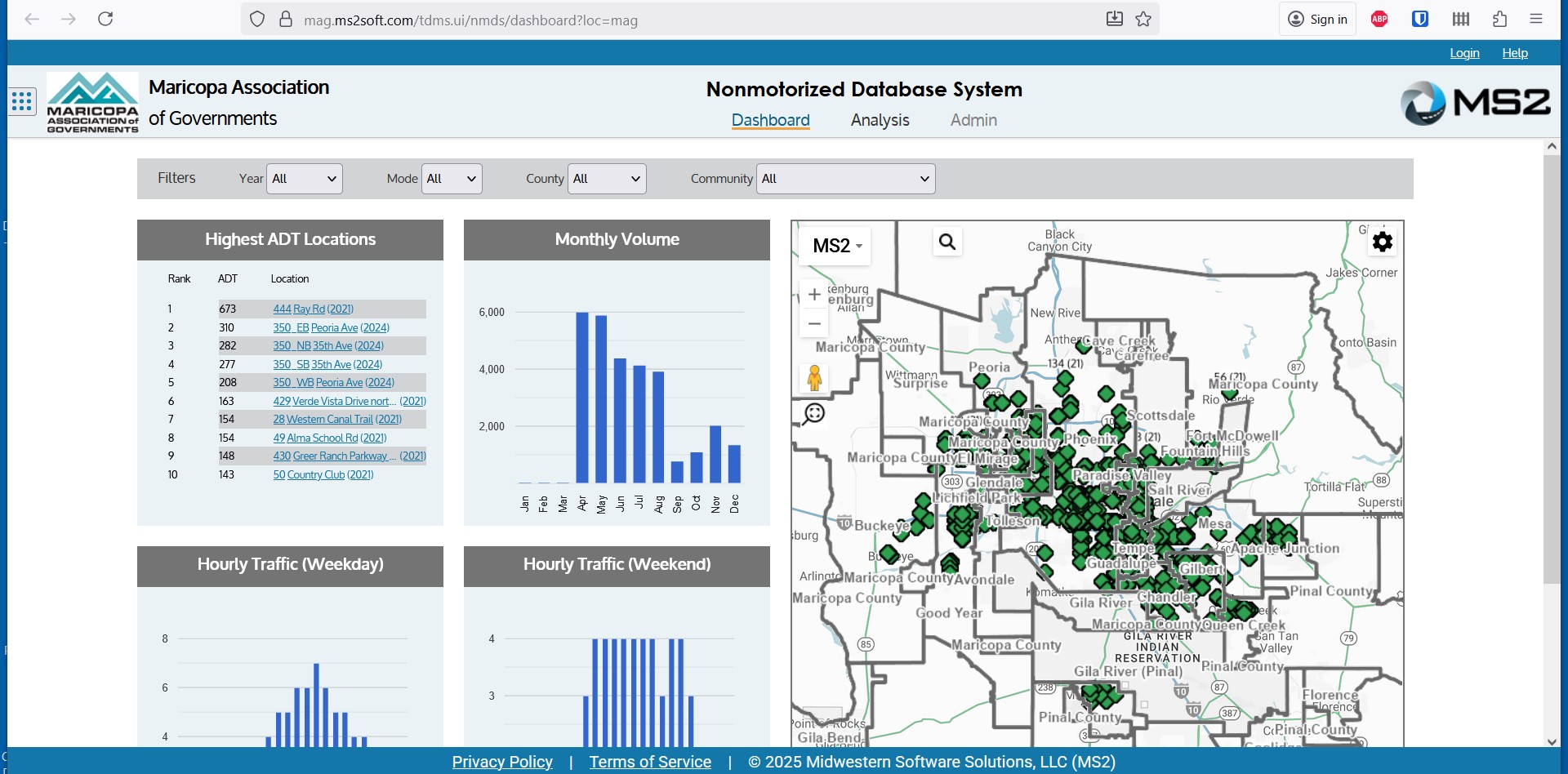
https://mag.ms2soft.com/tdms.ui/nmds/dashboard?loc=mag
PAG Bicycle & Pedestrian Volume Map
Recreation Map
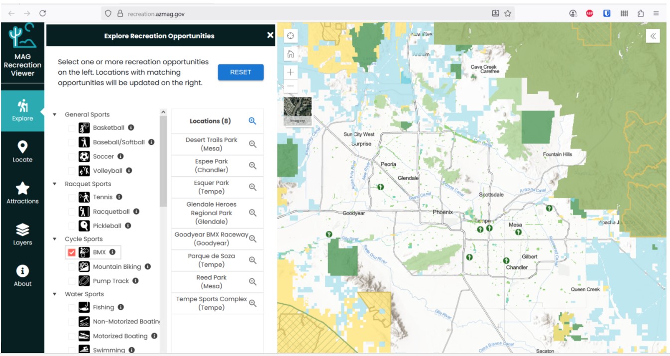
The Maricopa Association of Governments has a map that shows the location of different recreation opportunities in the Maricopa Region.
This map can be used to identify the locations of sports and recreation opportunities, including BMX tracks, mountain biking trails, and pump tracks.
MAG Recreation Viewer
Roadway Condition Maps
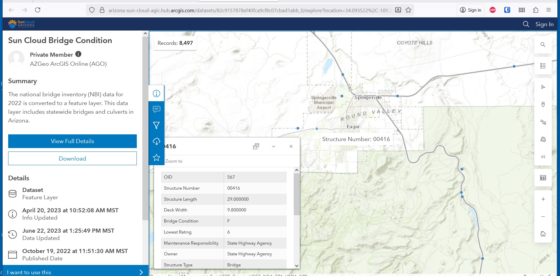
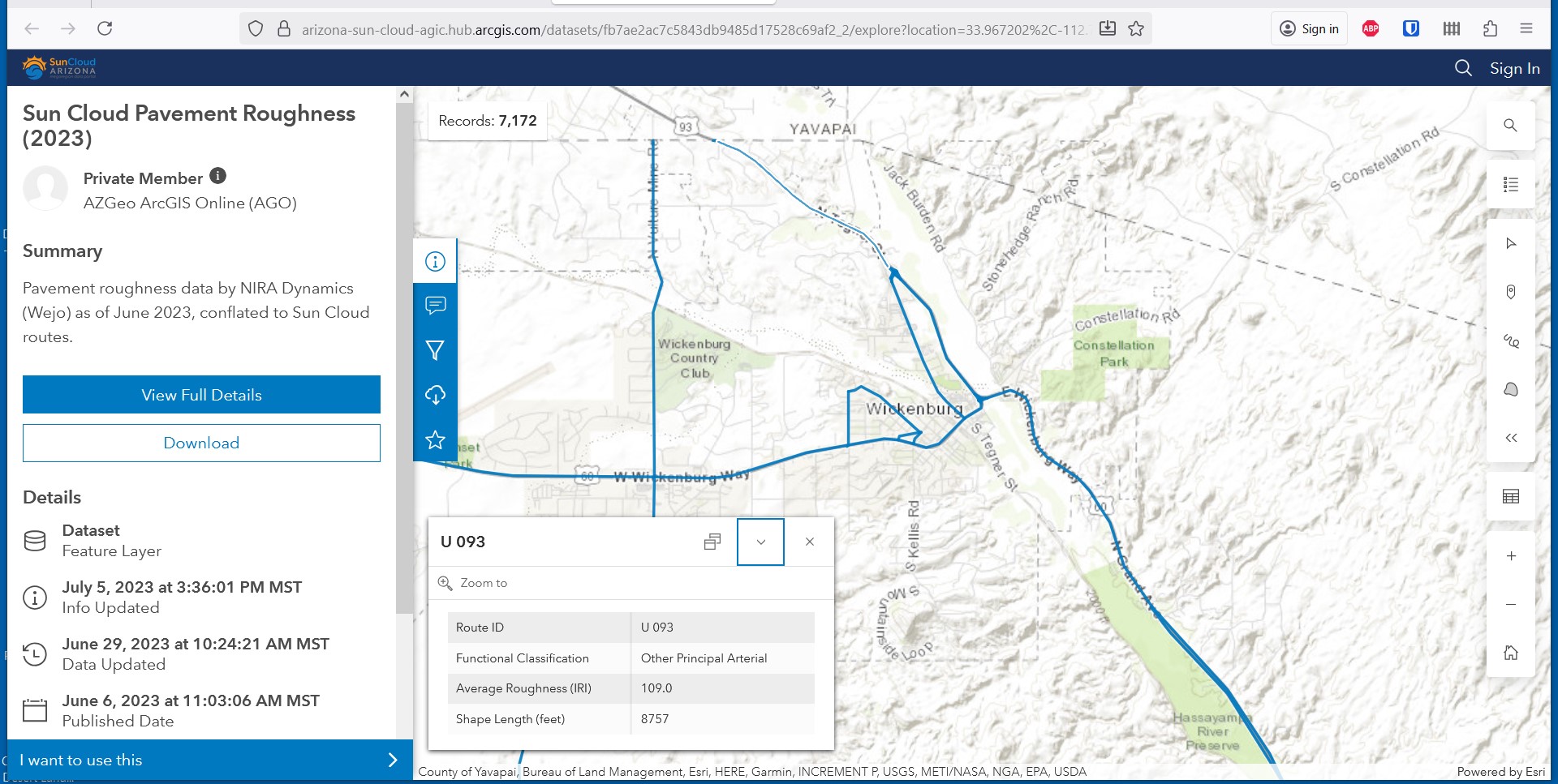
The Sun Cloud Explorer includes two maps that provide roadway condition information. One provides a rating of the pavement roughness by roadway segment. The other shows the condition of bridges.
These maps can be used to identify area where repaving or other improvements are needed or upcoming, and that information can be used when asking that bicycle lanes be added, improved, or widened as part of a larger project. These maps include Cochise, Maricopa, Pima, Pinal, and Santa Cruz counties.
Sun Cloud Bridge Condition Map
Sun Cloud Pavement Roughness Map
Roadway Ownership Maps
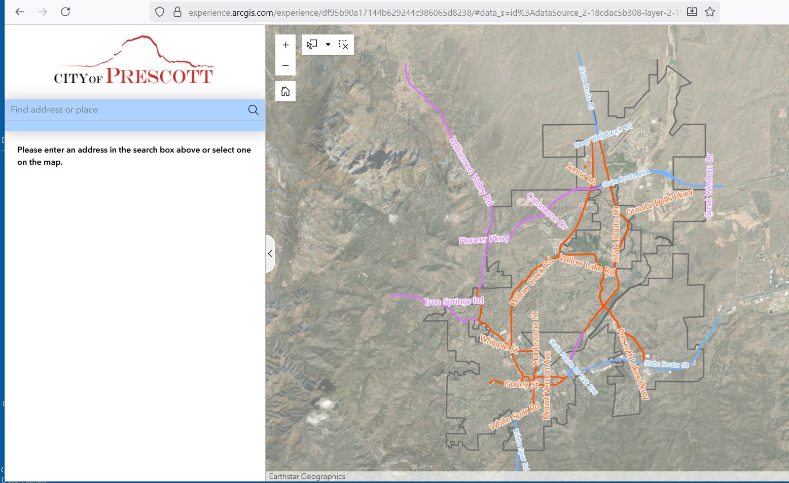
Sometimes you need to figure out who owns the roadway you are concerned about. Some communities and ADOT have maps that can help with that.
Prescott Road Ownership Map
ADOT Roads by Owner Map
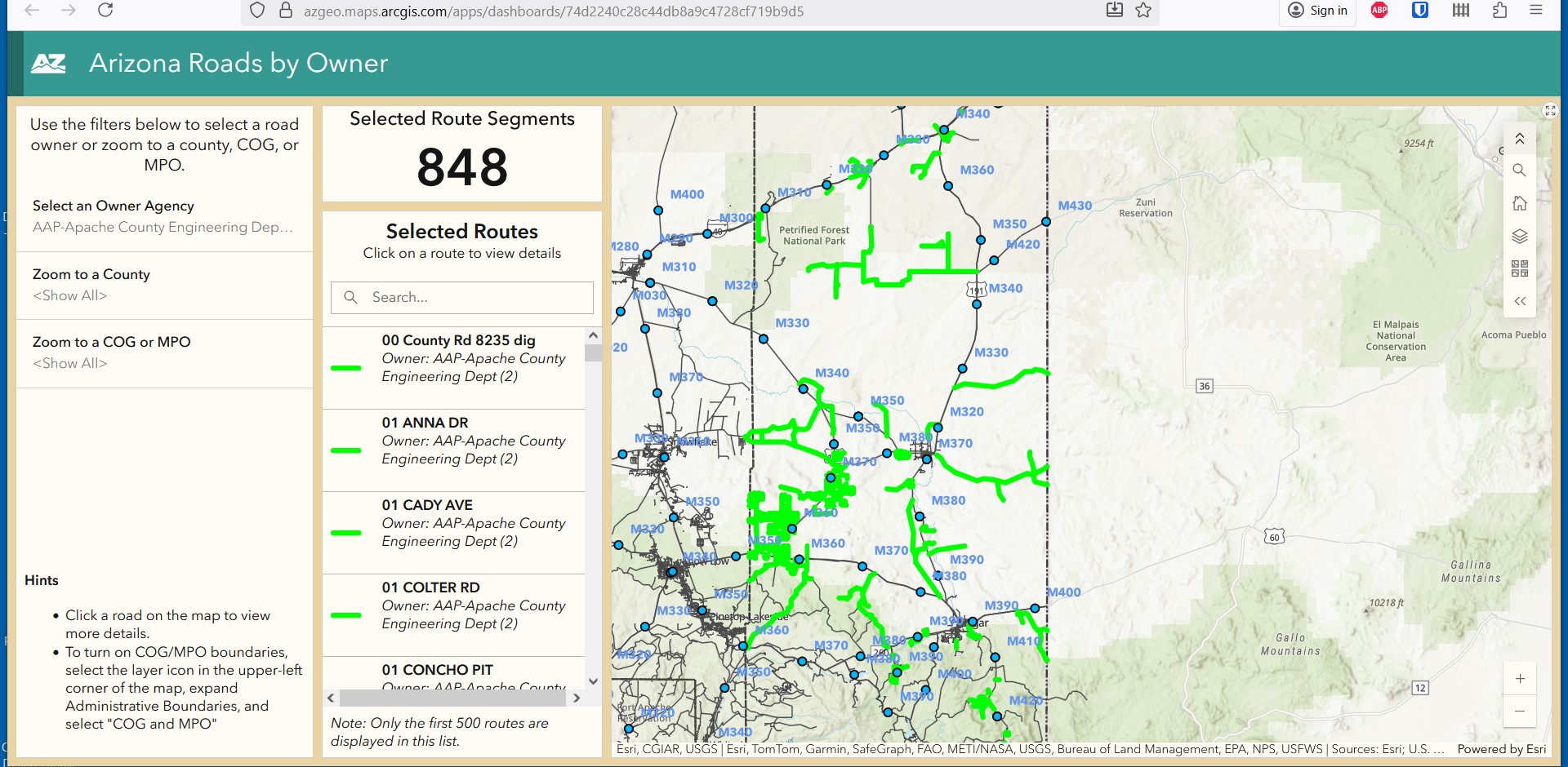
https://azgeo.maps.arcgis.com/apps/dashboards/74d2240c28c44db8a9c4728cf719b9d5
ADOT State Highway System Map
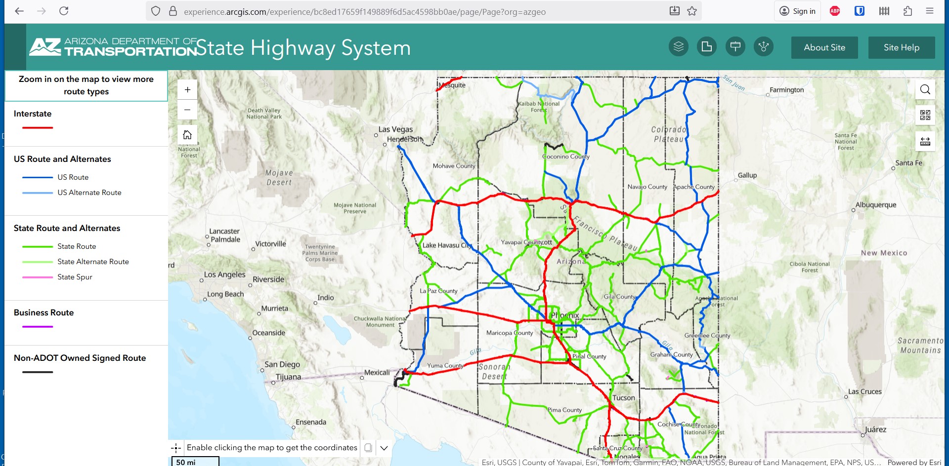
https://experience.arcgis.com/experience/bc8ed17659f149889f6d5ac4598bb0ae/page/Page/?org=azgeo
ARCGIS Roadway Ownership Map
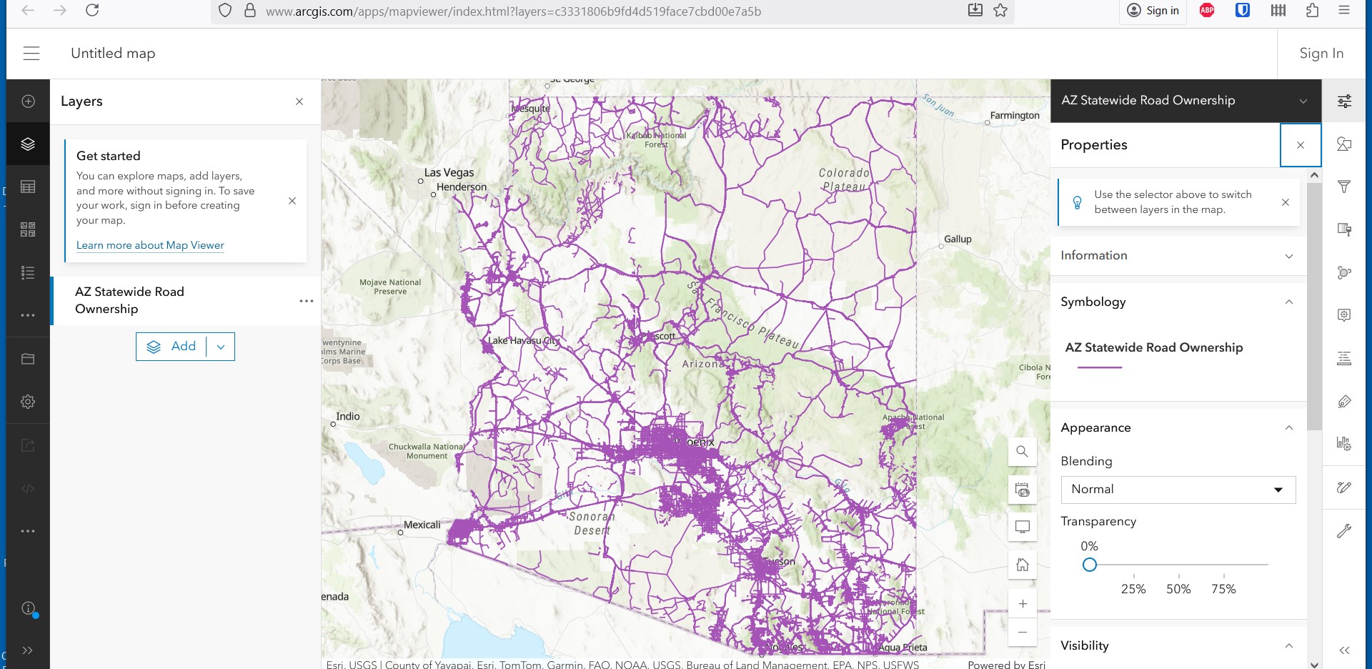
https://www.arcgis.com/apps/mapviewer/index.html?layers=c3331806b9fd4d519face7cbd00e7a5b
Roadway Safety Project Map
The City of Tucson’s Better Streets Safe Streets Map is an interactive map showing roadway safety projects in various stages of completion that are funded with Prop 411 dollars.
Tucson Better Streets Safe Streets
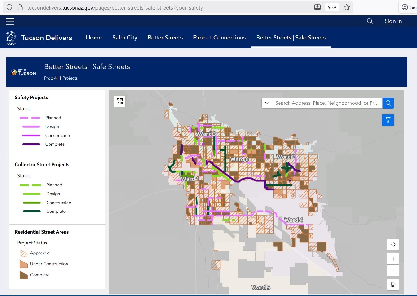
https://tucsondelivers.tucsonaz.gov/pages/better-streets-safe-streets#your_safety
Suggested Improvements Map
The Maricopa Association of Governments (MAG) also has an interactive map you can use to suggest improvements to active transportation in the MAG region and make comments existing infrastructure.
MAG Active Transportation Interactive Comment Map
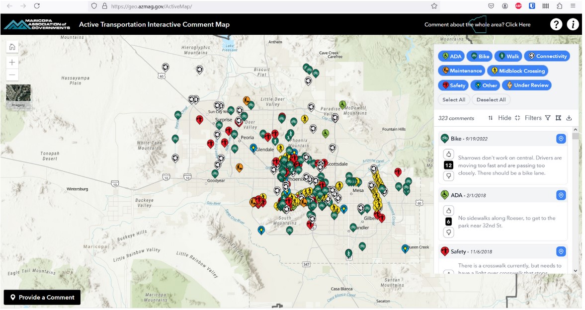
https://geo.azmag.gov/ActiveMap/
Travel Distance Maps
There are a couple of maps that can be used to estimate travel time using different modes of transportation.
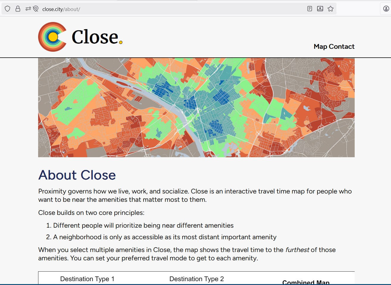
A map called Close provides information on neighborhoods that have destinations such as supermarkets and libraries conveniently located for people who ride bicycles, walk or take public transportation. In Arizona, Close includes maps for community’s large and small.
Close Travel Time Map
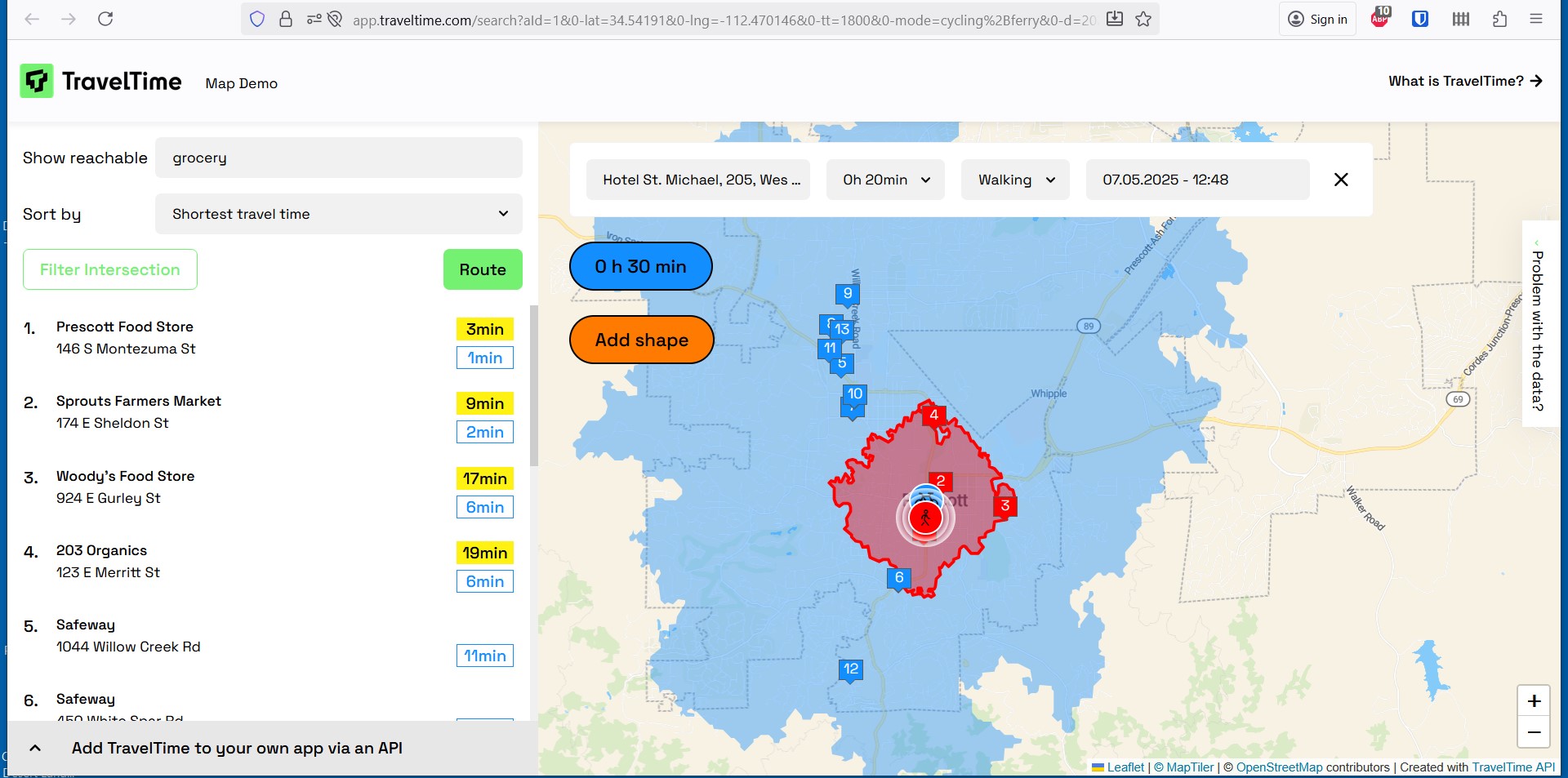
The TravelTime map also provides information about bicycle travel times and allows you to layer walking, biking and other transportation mode travel times on the same map.
TravelTime Map
Vehicle Ownership Map
The National Resource Defense Council has a map showing motor vehicle ownership rates by federal congressional district. This information is also available from the U.S. Census Bureau, but not in map format.
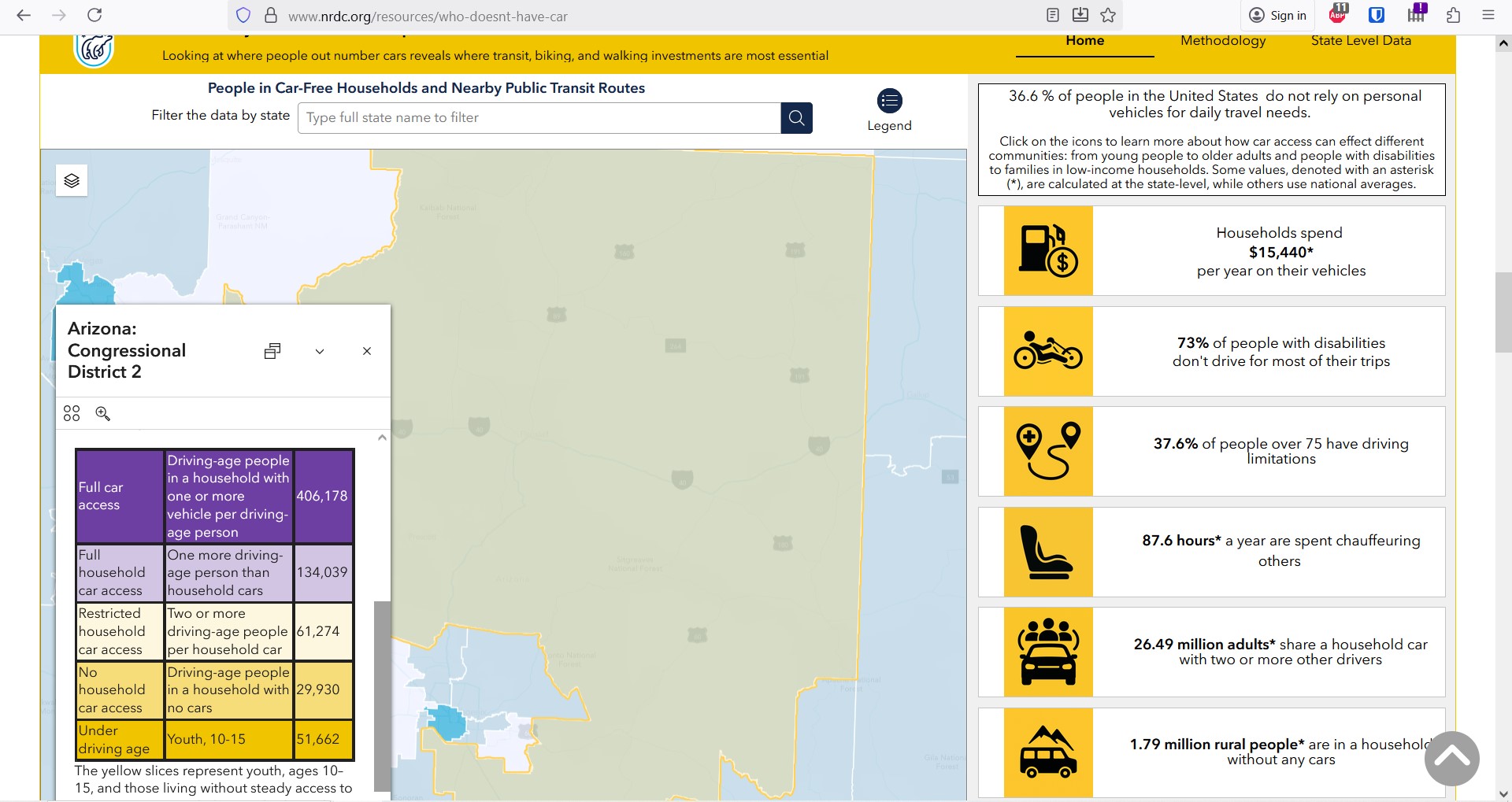
https://www.nrdc.org/resources/who-doesnt-have-car